Gavin's answer to stiles's Secondary 3 E Maths Singapore question.
done
{{ upvoteCount }} Upvotes
clear
{{ downvoteCount * -1 }} Downvotes

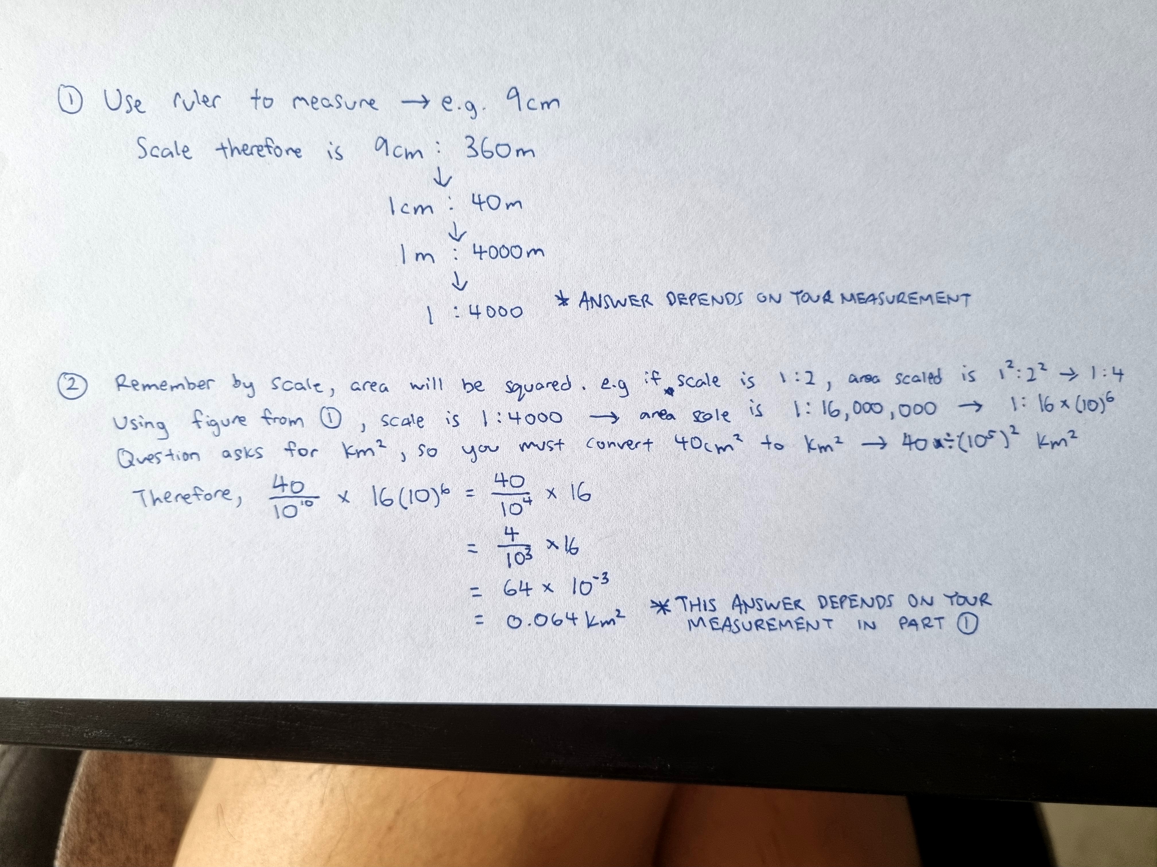
Part 1 is testing your ability to determine scale based on map drawing size. You will need to measure with a ruler the distance, and compare it with the stated distance in real life (360m) to find the scale.
This measurement will affect the next steps hence my answer is based on an assumption that the measurement is 9cm.
This measurement will affect the next steps hence my answer is based on an assumption that the measurement is 9cm.
Date Posted:
1 year ago